


Sean C. Morgan
The predominant public intrest points Monday night, Sept. 16, seemed to be getting something for All-Terrain Vehicle enthusiasts into the proposed South Santiam Community Forest Corridor and in making sure that tourism efforts in connection to the projects do not price Sweet Home citizens out of their homes as has happened elsewhere in the United States.
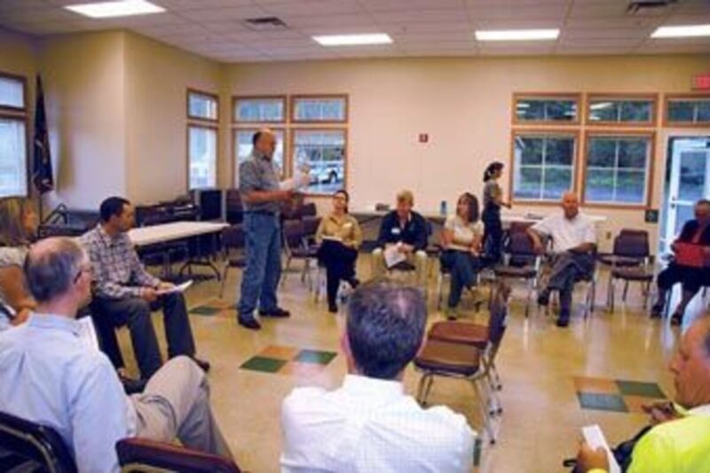
Four to six members of the public attended an informational meeting with partners involved in the Forest Corridor project, which began as a project of the Sweet Home All-Lands Collaborative, a partnership among numerous public agencies and private landowners in the Sweet Home area. Some 30 to 40 people have been working together on this project, including an Oregon Solutions team, created by Gov. Kitzhaber.
The Forest Corridor would provide a place that improves and demonstrates the connections between local residents and natural resources, allowing the residents and visitors to reconnect with the natural world, according to the project vision statement. It would establish a corridor from Sweet Home to the Willamette National Forest while respecting the rights and values of the landowners in between.
It would provide opportunities to coordinate land management on public and private forests, generating forest products and creation recreation and conservation education activities. The corridor is supposed to be self-sustaining, with revenue provided through the use of the land and forest products, along with grants and Forest Service stewardship contracting.
The vision is still a work in progress, said Linn County Commissioner Will Tucker, but some projects in relation to the All-Lands Collaborative are already under way, including the Cool Soda Planning Area, which primarily involves the Swet Home Ranger District and Cascade Timber Consulting. The two landowners share a patchwork of forestland in the Soda Fork drainage and are working on culvert replacement projects, developing early seral habitat, working out possible new trails and improving deer and elk forage to help protect seedlings.
Elsewhere, officials are trying to figure out how to get a trail from the old mill property, located between 18th and Clark Mill, to the Willamette National Forest. Sweet Home also is the subject of four federal Livability Initiative studies.
Also, the Forest Service and three Native American tribes are working with CTC on ways to transfer the Cascadia Cave, which features petroglyphs by Native Americans, into public ownership and stewardship. Right now it is on private land managed by CTC.
The corridor group has been meeting for about a year, said project manager Steve Bryant. It includes several project committees and a leadership team.
“Our goal is to finish in December with what we call a Declaration of Cooperation,” Bryant said. That document will detail how the different partners intend to support the vision and goals of the Community Forest Corridor.
When talking about the corridor, members of the committees use a map of the area including Sweet Home and the Sweet Home Ranger District. A blue band along the South Santiam River outlines possible borders.
“We have not identified any specific area in that blue band,” said Linn County Parks and Recreation Director Brian Carroll. “We’re looking at opportunities where we could connect those dots.”
The project is not a land grab, Tucker said.
Developing the corridor, officials know they will have to go around some properties, buy from willing sellers and cross where landowners are willing to provide access, Carroll said.
“This isn’t an overnight process,” said Jon Meier, a recreation specialist with the Sweet Home Ranger District. “This is a phased-in thing that could take a few years. Tourism may not be the savior economically, but it is one of the legs.”
He believes that the project could make Sweet Home more of a destination.
Among the public attending the meeting, Zach Lincoln, a local paramedic, said he purchased an ATV a while ago, but he has had a hard time finding places to ride in the area. He has had to go over to the Coast Range or the other side of the Cascades to find places to ride.
Carroll told him there are pots of money available at the state level that could provide opportunities to develop areas for riding ATVs. Area ATV clubs have also worked with Carroll to try to find places.
Noise is one of the of the major issues as they look for sites, he said.
Tucker urged Lincoln and others interested in ATV areas to stay vocal as this project develops.
Paul Bright, a Sweet Home independent filmmaker, asked who is the target of the tourism efforts – day hikers, overnight hikers headed for the Pacific Crest Trail, or something else?
Carroll said teh answer could be either, conceivably, depending on whether the Forest Service develops a trail on into the forest and possibly across to Sisters. It’s early in the process, and it brings other questions, lsuch as whether the proposed trail would also handle horses and mountain bikes.
Even if the Forest Service doesn’t build a trail all the way across the forest, the shorter trail, from Sweet Home to the National Forest boundary would be 12 miles long and would connect with Cascadia State Park at the east end.
Bright was concerned about how the corridor will be maintained.
He loves McDowell Creek Park, but few go to that park, he said. Trees fall along the trails there, and it takes awhile to get them off the trails.
The forest corridor project is a destination, Carroll said. McDowell Creek is a different kind of trail system. The county hasn’t promoted it much.
The county parks system has become self-sustaining, Carroll said, and it gets attention quicker than it used to. Still, it may take longer to clean up trails there than other locations.
The corridor and National Forest features several campgrounds, with the county managing the Forest Service parks, Carroll said, and part of the county’s effort there is promotion.
The Community Forest Corridor itself should operate like the county parks system, which is self-sustaining, Carroll said. The intent is for the Community Forest to be a working forest.
McDowell Creek will never pay its own way, Carroll said, but the camping elsewhere in the county parks systems pays the freight for those parks and McDowell Creek.
The Community Forest can operate under several different models, including different ownership patterns with different community management approaches. In some cases, the community may own the forest, while in others it may not and simply advises the landowners.
Part of the desire within the Community Forest is to launch tourism, Bright said, but tourists can’t be walking a trail along a clearcut without some explanation.
“Actually that’s one of the purposes of the Community Forest, is a place where we can teach management objectives,” said Sweet Home District Ranger Cindy Glick.
The Community Forest can let hikers know what’s going on, Carroll said. It can provide interpretation along the trail, including information about the protection and restoration of habitat, which is one of the objectives.
Human habitat is also a concern, whether it’s providing new jobs in the forest or how it affects property values. That’s where the Livability Initiative and study is timely.
“We are camped on the doorstep to public lands,” said Sweet Home City Manager Craig Martin. The upcoming livability study will look the key components that make Sweet Home a livable community and then in its second year focus on strategies to help develop those components.
Veil and Aspen, Colo., were once like Sweet Home, Martin said. In the process of becoming “over-loved,” they lost what made them livable.
There’s a reason everyone has chosen to live here when there are many other great places to live, Martin said. “We want to be paying attention to that as we move forward.”
Bright said he and his partner drove up Main Street and saw the beautiful flowers and that the town cares. That’s one of the reasons they moved here.
“It’s great to live in a place where you don’t have to pretend to be somebody you’re not,” he said. People, anyone, will talk about anything, and there aren’t any boundaries here.
He doesn’t want to see the same thing happen here that happened in Veil, Aspen, Bend or Sante Fe, N.M. He has seen them change. They get going, and “Hollywood shows up.”
He noted that tourism jobs don’t pay, and increasing property values can make property taxes unaffordable.
Sweet Home Public Works Director Mike J. Adams said Bright made good points, and long-term livability is among the goals identified in the city’s current visioning process, which will hold a public meeting on Nov. 13. Those are the same kinds of questions members of that committee are asking.
The vision needs to be consistent with the values of the community, Martin said. At the same time, this community has been desperate for jobs. At one point, it pursued the siting of a women’s prison. Tourism-related jobs won’t help put a new care in the driveway every three years, but it’s something. But affordable housing is among the components the livability assessment will study.
Bright noted that people who work in Veil and Aspen have to drive into town to work.
“How does the city manage to keep the property values from turning into the place you no longer prize?” Bright asked.
“How do we get our children to come back here?” asked former Mayor Tim McQueary.
“That’s why we are doing the livability assessment,” Glick said.