


Sean C. Morgan
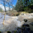
This may not be a big surprise: Wet weather systems have set records in the Willamette Valley and produced an unusually large snow pack in the Cascades.
While flooding was an issue in many areas during last week’s rain, “we don’t have any flood advisories out,” said David Bishop, a meteorologist with the National Weather Service in Portland, Friday. The area west of Salem had just a couple of warnings, but nothing around Sweet Home Friday afternoon.
As of Friday, Sweet Home had 10.44 inches of rain in 2017, .33 inches more than the same point in 2016.
As of Sunday, the pool at Green Peter Reservoir was at 961 feet above sea level, a little more than 18 feet above the target pool level for the day. Foster Reservoir was at 616.2 feet, .2 feet above its target level.
Salem was at 7.56 inches for the year, Bishop said. On Feb. 5, Salem received 2.44 inches, setting a record. The previous record was 2.17 inches, set in 1996. On Feb. 4, Salem had 1.53 inches, up from the previous record of 1.42 inches set in 1937.
Eugene set a record on Feb. 5 with 1.24 inches of rain. The previous record, .98 inches, was set in 1996.
Feb. 5, Sweet Home had 1.16 inches of rain, and on Feb. 6, an inch of rain fell.
“It’s definitely been wet the past week,” Bishop said. “It’s definitely been wet the first half of the month.”
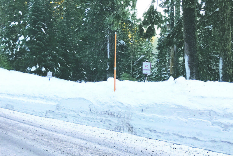
NWS hydrologist Andy Bryan said the snowpack is running “about 150 percent of average” in the Willamette Basin.
“We’ve got lots of snow,” he said.
East of Sweet Home, the snow pack is about 120 percent of normal, Bryant said, and snow levels are higher than usual around the state.
It’s similar to last year’s snow pack, he said, but last year, a warm March and April melted the pack quickly.
“We’re not anticipating those kind of conditions,” he said.
“We are going to have a little bit of a dry period for a few days,” Bryant said Friday, but he expected it to be wet again around the middle of the week.
Temperatures will be warmer, so snow levels likely will be higher, in the range of 3,000 to 4,000 feet, Bryant said.
Long range, the NWS has no strong indicators for spring, he said. Typically, the weather is wet through April.
“Plan for usual spring conditions,” Bryant suggested.