


Sean C. Morgan
Of The New Era
Wildland fires pose an increasing threat to people and their property, but three local state forestry workers are making an effort locally to reduce that risk through education and planning.
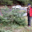
As they survey a new home on Green River Drive, Chris Dayton points out how most of the house has defensible space around it, but in the back the trees are packed tight beside the home.
“It really wouldn’t take a lot of work to make this place OK,” he says.
The home is already collecting leaves on the roof, his partner Brent Peterson notes, after knocking on the door to see if anyone was home. He leaves a bag with educational materials at the door before driving away.
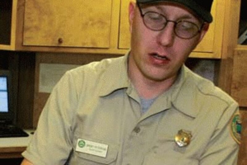
Retired Oregon Department of Forestry Sweet Home Unit Forester Lee Vaughn is working with Peterson, a forest officer with the Sweet Home Unit, and Dayton, a laborer with the North Santiam Unit to assess and map out fire hazards in what they call the wildland-urban interface, developed property adjacent to fire-prone wildlands.
The Linn County Board of Commissioners will soon adopt a Linn County Community Wildfire Plan, a collaborative process that started in February 2007. The plan will become part of the Linn County Natural Hazards Mitigation Plan, which the board adopted in 2006.
“Wildfire has played an important role in the formation of our forest and savanna ecosystems in Linn County and throughout the nation,” Vaughn said. “However, due to decades of fire suppression efforts on both private and public lands, the natural fire regimes that existed have been disrupted.
“This has resulted in abnormally high fuel accumulations in some areas. When a wildfire occurs in high-fuel areas, the result is usually a severe stand-replacing wildfire.”
The threat to people and their property is increasing as more homes are constructed in the wildland-urban interface, he said.
To address the concern, the legislature passed a bill in 1997 intended to reduce the threat to lives and structures by recognizing that property owners have a basic responsibility to minimize and mitigate fire hazards and risks found on their property, Vaughn said.
Federal agencies developed the National Fire Plan in 2000 after wildfires destroyed hundreds of homes throughout the nation, he said. The plan addresses firefighting resources, rehabilitation and restoration of fire-damaged ecosystems, hazardous fuel reduction and assistance to wildland-urban interface communities at risk to wildfires and accountability of natural resource agencies.
In 2003, Congress passed the Healthy Forest Restoration Act which sought to reduce fuel accumulations and return forests and rangelands to a healthier condition by using mechanical treatments, prescribed burning and other fuel-reduction projects on federal lands at risk to wildfire.
It encourages a community-based approach, with federal agencies, working in partnerships with state agencies, rural communities and property owners, Vaughn said.
The Community Wildfire Protection Plan identifies and prioritizes areas for fuel reduction on state and federal land near at-risk communities, he said, along with structure fire protection, emergency preparedness and wildfire response.
With the plan in place, communities become eligible for more federal grants, he said.
In 2002, the Sweet Home Unit used a National Fire Plan grant for projects in southwest Linn County, Vaughn said, and then in 2004, another National Fire Plan grant continued the effort in cooperation with the Brownsville, Sweet Home and Lebanon fire districts for fuels treatment, education and firefighting resource development.
As part of the program, Peterson and Dayton travel throughout the Sweet Home Unit and Linn County completing assessments of homes in the wildland-urban interface.
So far they have completed some 5,200 assessments out of an estimated total of 9,000, Vaughn said. They use handheld personal data assistants with GPS capability to document what they see on each property.
“What Chris and Brent are doing is going door-to-door,” Vaughn said. They work with landowners and identify hazards that increase the risk of losing a property to a wildfire when they are able to make contact with a property owner. If the property owner is not home, they leave educational material and use what they saw on the way in to knock on the door to help make an assessment of the property.
When assessing a home, they look at access issues, such as how long a driveway might be, the width of the road, bridges and whether it is the only access point, Vaughn said. Some roads are so narrow, only personal vehicles can get into the home.
They also look at the topography of the land, the types of vegetation growing there, whether a roof has moss on it, fuel around the home, power lines and utilities, water supply and much more, Vaughn said. Some types of vegetation will explode with fire, while others are less incendiary.
“People wonder, do I have to cut down all the trees?” Vaughn said. The answer is no. “You can have that juniper, but you’ve got to maintain it.”
Trees need to be pruned, so branches aren’t at ground level or against the house, Vaughn said, and gutters need to be clear of debris.
The pruning is to “make sure fire can’t go from small (vegetation) to the trees,” Peterson said. For that reason, homeowners should keep blackberries out and clear away branches that fall during windstorms.
The assessors score the houses on whether they’re survivable and make notes on what they can do to make the homes more survivable during a wildfire, Vaughn said. Some homes are not really defensible, but they can be made that way – a relatively safe area surrounded by wildfire where firefighters can protect a structure.
A “defensible” home is one where a firefighter can remain relatively safe, putting water on parts of the structure as it starts to smolder during a wildfire, Vaughn said. A “survivable” home is prepared enough that it likely could survive a wildfire in the area without firefighters even being there.
Peterson and Dayton are mapping out which homes in local communities are at what level.
Most homes on the map are colored yellow, which means they are somewhat defensible. Homes marked in green could survive a wildfire without help, while homes marked in red need help, Peterson said.
The worst case so far is a subdivision of expensive homes in the middle of nowhere, Peterson said. The homes are well-maintained, but the neighborhood has only one access point.
Getting to them is the hard part, Peterson said. Driveway bridges also are a big concern.
“You won’t want to go across any of them with anything of weight,” Vaughn said. They haven’t been engineered, so it’s hard to know if they’re safe for large vehicles, like fire engines.
“For the most part, people are really receptive,” Peterson said. Sometimes, a property owner is anti-establishment or thinks the program is a waste of tax dollars and is uncooperative. The assessors do what they can to assess those homes without trespassing.
While out making assessments, they also check road systems and compare them to the 911 map pages to make sure everything is up to date, Peterson said.
Their assessments are downloaded to a database that will be maintained by the Linn County GIS Department, Vaughn said. As part of the county’s Community Wildfire Protection Plan, that data may be used by local fire agencies.
Vaughn doesn’t know when the commissioners will vote on the plan, he said. The Department of Forestry has sent a letter of approval, but the Linn County Fire Defense Board has yet to act on it.
Peterson and Dayton will probably finish assessments this spring, Vaughn said, but “it’s basically a never-ending process. It’s been three years since we started.”
“We’re almost done with the high-risk stuff,” Peterson said. They may have 1,000 high-risk properties left to look at. After that, most of the remaining properties are lower-risk farmland. The two can assess 30 to 40 properties per day.
Forest officers will be able to update property assessments in the course of their patrols, Vaughn said.
For property owners who want to improve the survivability of their home, the Department of Forestry Sweet Home Unit has a chipper that it can loan to them, Vaughn said.
Forestry officials, working with property owners, have also provided new water sources.
“We’ve had several landowners we’ve gone to and asked to develop water supplies,” he said. They may improve access to a pond, dig a new pond or provide a place for a water tank. The Department of Forestry has reimbursed them for their costs.
The program to date has cost about $15,000 for equipment and $30,000 to $35,000 in staff time, Vaughn said.