


Sean C. Morgan
Of The New Era
Just beyond that next hill may be a treasure of natural beauty and history ranging back thousands of years to the Indians who originally settled the area.
It could be just one of many points of interest that line the new scenic byway running through Sweet Home, just waiting to be investigated by those willing to slow down and take a look.
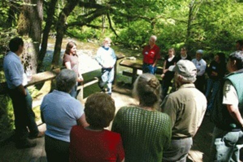
A small group of volunteers and members of the public got a chance to learn all about it Thursday as they traveled the new Over the Rivers –Through the Woods Scenic Byway from Brownsville to Yukwah Campground.
The tour followed the route from Brownsville City Hall, near the scenic byway’s beginning on Highway 228 off Interstate 5, to Sweet Home where the route runs east along Highway 20, morphing from a rural agricultural and small-town experience to the deep, natural forest managed by the U.S. Forest Service.
The byway ends on Highway 20 at the intersection with Highway 126.
“Some of us were lucky enough to be born here,” Brownsville Mayor Don Ware said. “Others were lucky enough to find it and choose to live here.
“We came up with one name after another until Mandy (Cole) came up with ‘Over the Rivers – Through the Woods.'”
That name was met with skepticism at first, like all the other names the committee came up with, until someone added “to Grandma’s house….” Then it was a hit, and the name stuck.
Cole, who helped get the scenic route designation on behalf of Travel Oregon, recognized a number of groups for their work on the byway. They included citizens of Sweet Home and Brownsville, Linn County Parks and Recreation Department officials, Travel Oregon, In-House Graphics, Bear Mountain Forest Products and the Sweet Home Ranger District.
Along the way on Thursday’s tour, Joni Nelson of Brownsville provided a brief history of Brownsville, pointing out the Moyer House, the home of Brownsville’s first mayor. Brownsville was settled in 1846, by folks who built homes on both sides of the Calapooia River. A mill race built through the north side drew a woolen mill, grist mill and more. The towns of Brownsville and North Brownsville had a great rivalry, but finally, in 1895, the two were consolidated.
The historical documentation includes the terms “in less than legal fashion,” Nelson said, although no one is exactly sure what that meant.
The bridge out of town was rebuilt four or five times. The first covered bridge there lasted from 1852 to 1861. The existing bridge was completed in 1932.
Across the bridge from downtown Brownsville and on the scenic byway is the Kirk Log Cabin, built by a Brownsville settler.
The cabin is covered in modern siding to protect the logs, Nelson said, but there are plans to expose the original logs.
Before this time, the Brownsville area had patches of old growth, with oak savannahs, she said. The waterways were lined with willow, cottonwood, filbert and ash trees. Indian burned camas fields in the area every year.
This is just the start of the scenic byway. Nelson can provide many more details about her historic city and the area around it.
From there, the route reads like a history book leading to the scenic byways of eastern Oregon .
“We started this program back in 1994,” said Pat Moran, Oregon Department of Transportation’s scenic byway program manager. It is meant for cities, counties and the state to showcase some of their scenic roads.
“This provides a portal not only to Over the Hills – Through the Woods but to our other scenic byways in Central Oregon,” Moran said. It allows travelers on I-5 to reach five Central Oregon routes using a scenic route.
It also connects communities and regions, tying together communities, like Sweet Home and Brownsville, along the entire route, he said. As for economic development, it may increase traffic to the region, and it becomes part of the statewide Travel Oregon marketing plan.
“It provides an opportunity for preservation,” he said. “It really is a feather in your cap to be able to go to ODOT for maintenance funding,” and it can help the communities access federal funding.
“You’re to be commended and congratulated on this designation,” Moran said.
Rod Fielder, who has written two books as “Oregon Bill,” joined Nelson in leading the tour as the bus, provided by the Sweet Home Senior Center, left the Brownsville area. He pointed out historical homes along Highway 228 and related stories of the past, while Nelson talked about the Calapooia Roundup which had its beginnings near McKercher Park before moving to Sweet Home.
Bud Baumgartner, chair of the Calapooia Watershed Council, talked about the 75-mile Calapooia River and watershed. The river’s flow, which has little snowpack to feed it, ranges from 10 cubic feet per second in the summer to 2,000 cubic feet per second at flood stage.
“Things happen quickly here at the Calapooia,” Baumgartner said. Rain at McKercher reaches Albany in 24 hours, he said.
In past years, the river was used to move as many as 5 million board feet of logs downriver during the winter, he said. Right now, the Calapooia Watershed Council is working on removing the Brownsville Dam from the river and providing more access for fish to reach large habitat areas. The Watershed Council is working on a method to keep water in the Brownsville Canal.
Weyerhaeuser is doing all kinds of restoration projects in the watershed, he said. The river has steelhead and Chinook runs.
The byway soon passes over the hill from the Calapooia to the South Santiam watershed as it passes Holley to Sweet Home. It passes by the East Linn County Museum and the byway’s Sweet Home kiosk, built by LND Construction and Linn County Parks and Recreation with information panels designed and printed by In-House Design of Brownsville.
Driving through Sweet Home, City Manager Craig Martin pointed out the work that Alice Grovom and her Beautification Committee have done in the median and along the sides. When she is finished having her way, Sweet Home’s Main Street will have flowers from one end to the other, he said.
He pointed out the Jamboree Grounds and Community Center, with the Weddle Bridge, Ames Creek and Sankey Park backdrop.
Ames Creek “has gone through so many phases of use,” at one time a log pond surrounded by mills, Martin said. “Now it’s being restored back as close as possible to how it was.”
The tour took a break for lunch at Foster Lake Campground, with a view of Foster Lake across Highway 20. Lunch was provided by the campground, Mollies and the Waterhole.
Historian Gail Gregory of Sweet Home talked about some of the families, the Mealeys, Riggses and Sheas, who settled where the lake is now and on the hills above.
The road through the area “was almost like a jeep trail coming over the hill into Sweet Home,” Gregory said.
Heading east into the mountains, Sweet Home Ranger District Archaeologist Tony Farque explained, “this is a travel route that has been recognized for millennia for its features. This part of the world is very impressive.”
It has useful plants, animals, shelter, water and medicine, he said, and the Calapooia Indians who lived in the area used it all for thousands of years. Their descendents are among the Siletz, Grand Ronde, Warm Springs and Klamath tribes.
“They were wiped out by disease quickly,” Farque said. Survivors were taken to the reserves.
The Indians of the Sweet Home area traded with the Molalla Indians to the east.
“When they went east, they went right up the Santiam River,” he said. “As the settlers came into this area, they also recognized the amazing travel way here.”
“Over time, these settlers here decided they wanted to go back east, to eastern Oregon,” retired Sweet Home Ranger Rolf Anderson said. They were enticed by the lush rangeland and mining opportunities. Andrew Wiley put together a group of men, who scattered over the old Indian trails to the east.
Camped at Lost Prairie, they could not see how to get across the Cascade summit, he said. The story is that Wiley climbed a big pine tree and was able to spot the pass. Soon, the Santiam Wagon Road was developed in a program that granted land as companies constructed the road.
That’s where the checkerboard pattern of ownership on the Sweet Home district came from, he said. Private land is mixed with public to the north of Highway 20. What resulted was a wagon toll road used into the 1920s, and Highway 20 was eventually paved and opened in 1930.
At Cascadia State Park, Farque explained that, at one time, most of the forest probably looked like the park, with the Indian tribes burning away the underbrush. A chief now might say the forest looks like untended weeds.
The Civilian Conservation Corps of the 1930s also left its mark on the byway at places such as Longbow Organizational Camp and other Forest Service campgrounds, where it built several structures. The Corps also worked on miles of trails and helped fight fires in the region.